
Keyword
Marine Planning Regions (Australia) | North-west
4 record(s)
Type of resources
Topics
Keywords
Contact for the resource
Provided by
Formats
Update frequencies
Status
draft
-
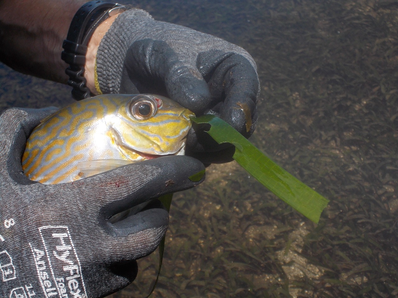
Herbivory is a key ecological process that sustains food webs, and can regulate the biomass of primary producers in an ecosystem. It has long been hypothesized that rates of herbivory are greatest in the tropics, although strong evidence to support this is limited. The aim of this project was to identify the key species of herbivores, to identify the grazing rates of key herbivores, and in conjunction with project WAMSI 2 KMRP Project 2.2.4 (benthic primary productivity) provide estimates of the proportion of production that is consumed by herbivores. The research on herbivory was focused on the islands and coast of the Bardi Jawi Indigenous Protected Area in the Kimberley (Western Australia), encompassing Jalan (Tallon Island) and Iwany (Sunday Island). Focus of the herbivory study was on one type of habitat (seagrass meadows), and the diet of two species of herbivores (golden-lined rabbitfish and green turtle). Four surveys were conducted between October 2014 and April 2016. At these locations the following measurements or collections were made (not all measurements were made during each survey): (1) Rates of herbivory (three surveys). These data are presented in the report for WAMSI KMRP 2.2.4, here the focus is on assessing rates of herbivory as a proportion of primary production; (2) Collections of golden-lined rabbitfish (Siganus lineatus); and (3) Blood samples from green turtles (Chelonia mydas). Ten green turtles were tagged with satellite tags: 4 in April 2015, and 6 in April 2016. This data record only pertains to data held by CSIRO. For access to all other data generated by collaborative research partners of the KMRP 1.1.2 project refer to the additional metadata field.
-
KSN Project 2.2.2 provides key information on the oceanographic and biological forcing associated with nutrient supply that determines the near-shore productivity of the Kimberley region, and links these with higher trophic levels. Key objectives of the research were - To make new estimates of pelagic primary productivity, identifying the key physical and community processes driving production in the region. - To better describe the phytoplankton and zooplankton communities in coastal waters of the Kimberley, to determine the trophic linkages within these communities and to identify the key factors controlling pelagic secondary productivity. - To integrate these parameters into an extensible biogeochemical modelling framework, allowing predictive linkages between physical and biological processes in the region. This metadata records specifically relates to modelling aspects of the project completed by CSIRO. The data originates from a number of model simulations conducted between 3/1/2010 to 21/12/2010. All field data are held at Pawsey and RV Southern Surveyor and RV Solander.
-
The physical oceanographic environment of the morphologically complex Kimberley coast is globally unique with deep and narrow inlets and extensive island archipelagos interacting with a macrotidal regime. KSN Project 2.2.1 investigated the processes controlling physical variability (e.g. circulation and temperature variability) within the Kimberley’s shallow water macrotidal reef environments, including transport and exchange rates between reef and coastal waters. An intensive field study are conducted at Tallon Island between 22nd March 2014 to 13 April 2014. A number of moorings were placed on the tidal reef flats. Consisting of Acoustic Doppler Velocimeters, temperature loggers and an Acoustic Wave and Current Meter (AWAC) An RTK bathymetry survey was also conducted over a number of days during the field program. A weather station was also deployed on a scaffold tower in the intertidal area. Weather station measured was used to measure wind speed, air temperature, solar radiation and barometric pressure. Data associated with this metadata record pertains to 4 Nortek Vectors deployed on the reef and a weather station mounted on in the lagoon.
-
The Kimberley region is vast, remote and difficult and expensive to access and carry out field work in. Remote sensing technologies can provide cost effective methods to gather historical and baseline data at synoptic scales as well as near-real-time observations from metre to kilometre resolution. The Kimberley Node Project 1.4 focused on monitoring turbidity with reference to its impact on the water column and substrate light environment. The projects objectives were to analyse uncertainties of remotely sensed turbidity products by comparison of different algorithms and different resolution products with each other and with archived in situ data; and to analyse time series of remotely sensed turbidity data to provide first-stage pilot products that may be applicable for future use as marine management tools. In-situ water quality data was obtained from a number of cruises that occurred along the Kimberley coastline including Collier Bay; Walcott Inlet, Outer King Sound, Koolama Bay and Lesueur Islands, Van Diemen Gulf and the Pilbara Coast and used to validate remote sensing products. Data associated with this metadata record relates to in-situ water quality. MODIS satellite data obtained from IMOS has not been stored as part of this record, but can be accessed direct via IMOS (http://www.imos.org.au/).